


BENSALEM TWP VTD UPPER WEST, Bucks County, Pennsylvania
About
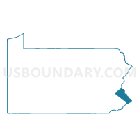
Outline

Summary
| Unique Area Identifier | 657618 |
| Name | BENSALEM TWP VTD UPPER WEST |
| County | Bucks County |
| State | Pennsylvania |
| Area (square miles) | 1.56 |
| Land Area (square miles) | 1.25 |
| Water Area (square miles) | 0.31 |
| % of Land Area | 79.97 |
| % of Water Area | 20.03 |
| Latitude of the Internal Point | 40.06709520 |
| Longtitude of the Internal Point | -74.96024790 |
Maps


Graphs
Select a template below for downloading or customizing gragh for BENSALEM TWP VTD UPPER WEST, Bucks County, Pennsylvania


Neighbors
Neighoring Voting District (by Name) Neighboring Voting District on the Map
- BENSALEM TWP VTD LOWER MIDDLE DIST 01, Bucks County, PA
- BENSALEM TWP VTD LOWER WEST DIST 01, Bucks County, PA
- Delanco township voting district 1, Burlington County, NJ
- Delanco township voting district 3, Burlington County, NJ
- Delanco township voting district 4, Burlington County, NJ
- PHILADELPHIA WD 66 PCT 22, Philadelphia County, PA
- PHILADELPHIA WD 66 PCT 33, Philadelphia County, PA
- PHILADELPHIA WD 66 PCT 43, Philadelphia County, PA
Top 10 Neighboring County Subdivision (by Population) Neighboring County Subdivision on the Map
- Philadelphia city, Philadelphia County, PA (1,526,006)
- Bensalem township, Bucks County, PA (60,427)
- Delanco township, Burlington County, NJ (4,283)
Top 10 Neighboring Place (by Population) Neighboring Place on the Map
Top 10 Neighboring Elementary School District (by Population) Neighboring Elementary School District on the Map
Top 10 Neighboring Unified School District (by Population) Neighboring Unified School District on the Map
Top 10 Neighboring State Legislative District Lower Chamber (by Population) Neighboring State Legislative District Lower Chamber on the Map
- General Assembly District 7, NJ (219,914)
- State House District 18, PA (63,223)
- State House District 170, PA (60,573)
- State House District 169, PA (58,190)
Top 10 Neighboring State Legislative District Upper Chamber (by Population) Neighboring State Legislative District Upper Chamber on the Map
- State Senate District 5, PA (255,921)
- State Senate District 6, PA (253,674)
- State Senate District 7, NJ (219,914)
Top 10 Neighboring 111th Congressional District (by Population) Neighboring 111th Congressional District on the Map
- Congressional District 3, NJ (680,341)
- Congressional District 13, PA (674,188)
- Congressional District 8, PA (672,685)
Top 10 Neighboring Census Tract (by Population) Neighboring Census Tract on the Map
- Census Tract 362.03, Philadelphia County, PA (5,129)
- Census Tract 1001.04, Bucks County, PA (4,498)
- Census Tract 7008, Burlington County, NJ (4,283)
- Census Tract 363.01, Philadelphia County, PA (3,695)
- Census Tract 1001.05, Bucks County, PA (3,297)
- Census Tract 1001.02, Bucks County, PA (2,720)
- Census Tract 1001.03, Bucks County, PA (2,402)